Every structure, whether it is a building, a road or other object, needs to have a foundation. Simply put, it must be supported on the ground. Unfortunately, the surface of the ground formed under complex conditions in Lithuania resulting in major variations location-wise caused by a wide range natural processes which still have a major impact on it. This includes a range of factors starting with glaciers, which shaped the current landscape of Lithuania and reshaped the soil in the South-Eastern Lithuania, and ending with the impact of the wind causing sand movement almost across the country during the Ice Age and forming the entire Curonian Spit relatively recently. On top of that there is also ground water activity and water flowing on the surface: all this results in undercut slopes leading to collapses or landslides in some places, whereas in other places it washes off the fertile soil or entire fields are covered with sediment. An active wetland formation process started in the territory of Lithuania after the Ice Age, which is still noticeable. Almost all smaller or bigger relief ravines turned into wetlands over the course of several millennia, in many places they were covered with soil layering over them and now even the most skilled expert cannot always spot thick layers of fragile soil laying under the surface of the ground.
Only engineering geological and geotechnical surveys or, simply put, the foundation soil (base) surveys can help you to prevent surprises of the nature on construction sites. Moreover, in the modern world everything is planned and calculated, thus you will not be able to accurately calculate the depth of the foundation or the price of it without accurate knowledge of the base of the structure. There can be no guarantees regarding stability of the building both within the course of the construction and many years after it. Moreover, having no knowledge about the geological conditions, you could encounter a variety of obstacles even during the construction: first of all there is the matter of ground water, which would complicate the construction work significantly, notably increase the construction price of inadequately selected foundation or even cause to change the design and begin the work again. Without the respective surveys you can never be sure how ground water would affect the structure during a different season of the year, like in winter and especially in spring, even if you do not encounter any major problems within the course of the construction. On top of that there is also the long-term cycle of ground water fluctuations, which poses a risk of potential flood even several years later. Rising ground water will dampen the structures and reduce their resistance; if this process is further affected by a stream of water, you might be in need for repairs of the structure rather soon, which often is rather costly.
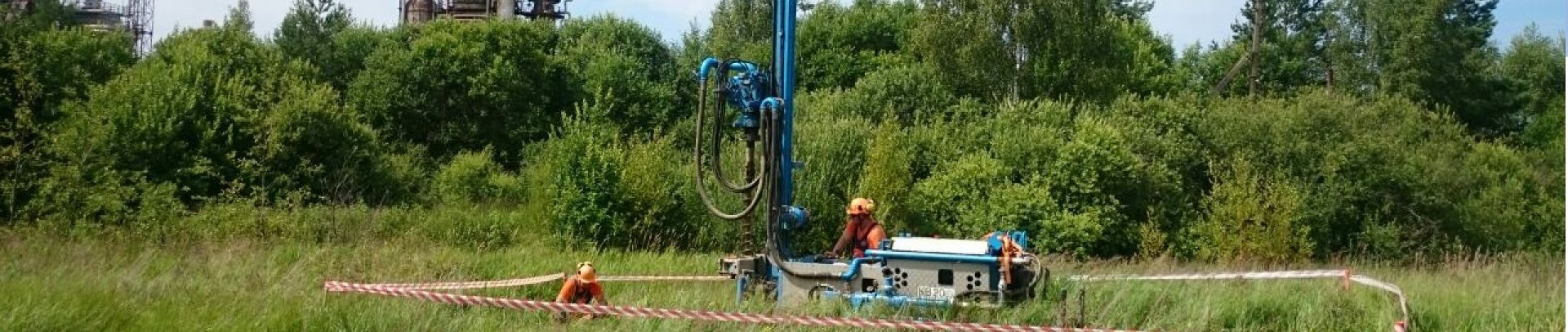
It should be noted that, in accordance with the legislations of the Republic of Lithuania and the European Union regulating the construction process, engineering geological and geotechnical (EGG) surveys are a mandatory part of the process of designing and construction of structures, whereas the EGG survey report is a mandatory document to be included in the design of a structure. The engineering geological and geotechnical conditions of the planned construction site are assessed, geological layers and their positions are determined, the soils comprising them are identified along with their description and classification as well as characterisation of their physical and mechanical properties with the course of the EGG survey. The surveys are carried out in accordance with the technical task submitted by the customer (we can offer our assistance in preparation thereof, if necessary), a survey program is developed and arranged with the customer having commissioned the survey or the designer, if such a need arises, the locations for the wells and other survey sites are selected.
The following survey methods can be applied depending on the survey task and the conditions:
• Drilling wells by using the borehole, column, or hammering technique;
• Sampling of disturbed and undisturbed soil structure;
• Static probing (CPT, CPTU);
• Dynamic probing (DP);
• Standard penetration test (SPT);
• Other field tests;
• Laboratory analyses and tests of soils in order to determine physical and mechanical properties.
Within the course of engineering geological (geotechnical) surveys we determine the following:
• Geological structure of natural and technogenic soils and solids;
• Geological processes, phenomena, their activity and associated threats;
• Hydrogeological conditions;
• Physical, mechanical, and chemical properties of soils and solids;
• Dynamics and stability of soils;
• Seismic activity of the territory;
• Interaction of the designed structures with the geological environment.
Our contacts
UAB „Geoinžinerija“
Address: M.Sleževičiaus g. 7, LT-06326 Vilnius
Office: +37052729215;
Cell: +37067933234;
Email:
marius@geoinzinerija.lt
;
Company code: 303106983
Company VAT code: LT100007929219
Bank name: Bankas „Swedbank“ AB
Bank account number: LT467300010136351934